RTK GPS dredging has transformed how sediment removal, channel restoration, and infrastructure protection are performed across the state. As waterways throughout California face rising pressure from extreme weather cycles, sediment-laden inflows, and strict environmental requirements, the need for highly accurate, highly controlled dredging has never been greater. Traditional dredging methods often fall short in sensitive environments where every inch matters. This is where modern systems integrating precision dredging excavators and advanced digital positioning have become essential tools for restoring waterways without disrupting surrounding ecosystems.
California’s complex network of rivers, reservoirs, deltas, estuaries, ports, and flood control channels demands a higher level of accuracy than many regions in the country. From the Sacramento–San Joaquin Delta to the Port of Los Angeles, operators now depend on RTK GPS dredging systems to execute projects with far more control and accountability. This technology is not only redefining quality expectations but is also helping contractors demonstrate compliance with state agencies, including the California Coastal Commission, Department of Water Resources, and regional water boards.
At the forefront of these innovations is CA Dredge Pros, a company known for delivering unmatched accuracy in California waterways dredging projects using advanced precision dredging excavators equipped with real-time RTK positioning. Their approach blends technical expertise, environmentally responsible operations, and cutting-edge hardware to achieve results that other contractors often struggle to match.
Why California Waterways Demand High-Precision Dredging
California’s Challenging Hydrology
California is home to some of the most variable hydrological systems in the United States. Dramatic shifts between drought and heavy rainfall create irregular sedimentation patterns. In regions such as the Central Valley, rapid snowmelt combined with stormwater flow can deposit sediment in critical channels within weeks. California waterways dredging must therefore adapt to constantly changing sediment levels, navigational hazards, and regulatory requirements.
Environmental Sensitivity Across the State
California hosts numerous protected habitats, including salmon migration corridors, eelgrass beds, delta smelt zones, and marine sanctuaries. Traditional dredging poses a risk of over-cutting or disturbing areas outside project boundaries. With RTK GPS dredging, operators significantly reduce this risk by maintaining accurate excavation lines and depth controls, ensuring disturbances remain within approved limits.
Regulatory Oversight and Compliance Pressures
State agencies require detailed reporting, before-and-after surveys, environmental monitoring, and proof of precise sediment removal. Precision dredging excavators equipped with RTK positioning help contractors like CA Dredge Pros meet these expectations by capturing real-time, accurate operational data.
These combined challenges are why RTK GPS dredging is not just a technological upgrade but a necessary evolution for successful California waterways dredging projects.
Understanding RTK GPS Technology in Modern Dredging
How RTK GPS Works
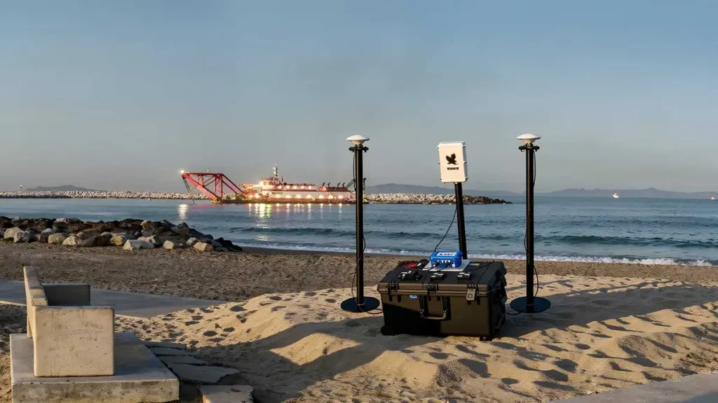
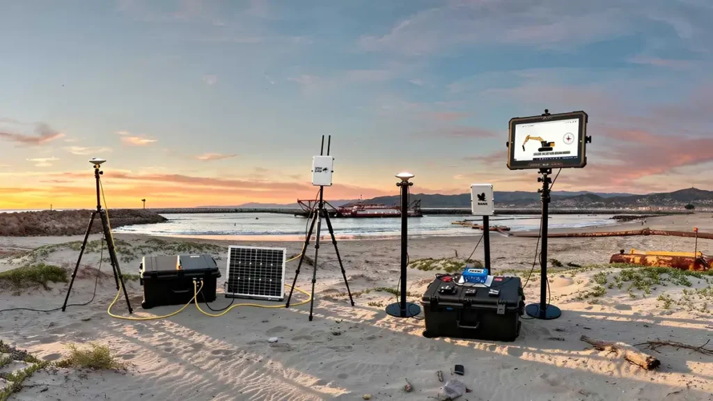
RTK, or Real Time Kinematic positioning, uses fixed base stations to transmit correction signals to GPS receivers mounted on excavators or other dredging equipment. These corrections allow the machinery to operate with centimeter-level accuracy. Unlike conventional GPS, which can drift several feet, RTK is engineered for exact control.
Application in Precision Dredging Operations
When installed on precision dredging excavators, RTK provides:
- Exact bucket depth readings
- Real-time visualization of cut lines
- Dynamic feedback for operators
- Reduced reliance on manual surveying
- Ability to work in low-visibility waters
These capabilities make RTK GPS dredging a powerful tool for tasks that require precise footprints, such as levee clearance, marina dredging, and habitat restoration.
Instant Feedback for Operators
With a digital display inside the excavator cab, operators can see their bucket position relative to design specifications at all times. This allows each cut to be executed with accuracy, preventing over-excavation while still achieving exact dredge depths.
The Role of Precision Dredging Excavators in California Projects
What Makes These Excavators Different
Precision dredging excavators are modified to integrate multiple sensors, including:
- RTK GPS receivers
- Inclinometers for boom and stick angle
- Bucket positioning sensors
- Digital depth mapping software
This equipment turns a standard excavator into a calibrated dredging instrument.
Critical Uses in California Waterways
These advanced excavators are ideal for:
- Delta channel maintenance
- Reservoir desilting in regions like Oroville and Shasta
- Urban stormwater basin dredging
- Marina deepening along the coast
- Flood control projects in Southern California
Because many of these areas cannot tolerate traditional dredging inaccuracies, precision dredging excavators ensure the project footprint stays exactly within permitted limits.

Why CA Dredge Pros Leads the Industry
While several contractors operate excavators, few in the region are deeply experienced in pairing them with RTK systems and environmental workflows tailored to California. CA Dredge Pros uses advanced modeling tools, refined operator training, and strict quality control protocols to deliver results that exceed the typical industry standard in California waterways dredging.
Benefits of RTK GPS Dredging for California Waterways
- Centimeter-Level Accuracy
Because RTK GPS dredging provides live positional data, contractors maintain exact control over dredge depth and boundary limits. This avoids costly over-cuts and ensures the project achieves approved specifications.
- Reduced Environmental Disturbance
Sensitive habitats throughout the state benefit from accurate sediment removal. Over-dredging can destabilize banks, expose submerged vegetation, or release buried contaminants. RTK systems minimize these risks.
- Lower Project Cost and Waste
Precision cuts reduce the volume of material removed, lowering transport and disposal costs. Many municipal clients in Los Angeles and Contra Costa Counties have turned to precision dredging as a cost-saving strategy.
- Enhanced Safety for Operators
In murky waters where visibility is poor, operators rely on RTK systems rather than underwater cameras or guesswork. This reduces on-site hazards and promotes safe excavation.
- Real-Time Data for Reporting
RTK systems automatically document bucket location, dredge lines, and progress. This allows CA Dredge Pros to prepare accurate compliance reports for agencies that oversee California waterways dredging projects.
How CA Dredge Pros Uses RTK GPS Technology to Excel
A Deep Understanding of Local Waterway Behavior
California waterways have unique sediment compositions, ranging from fine delta silt to compacted coastal sand. CA Dredge Pros has years of experience working in these conditions, giving them unmatched insights into how sediment behaves at different depths, temperatures, and flow rates.
Integration of Advanced Modeling Tools
Before deploying precision dredging excavators, the team creates digital dredging maps and cut line models tailored to each environment. These designs are uploaded directly to the excavator, enabling seamless RTK GPS dredging accuracy.
Highly Skilled Operators
Operator proficiency is crucial. CA Dredge Pros invests in training that combines digital navigation with mechanical skill. Their operators know how to maintain accurate cuts even in turbulent flows, tidal currents, or narrow channels.
Commitment to Environmental Stewardship
With California’s strict environmental oversight, dredging companies must demonstrate responsibility and transparency. CA Dredge Pros consistently meets these obligations with data-rich reporting generated through RTK GPS dredging logs.
California Regions Where Precision Dredging Is Most Critical
Sacramento–San Joaquin Delta
The Sacramento–San Joaquin Delta is one of the most hydrologically complex and environmentally sensitive regions in the United States. Sediment accumulation here can obstruct water export systems, restrict navigation routes for commercial and recreational vessels, and negatively affect critical habitat for salmon, smelt, and migratory birds. Because the Delta operates under strict environmental regulations, every dredging action must be carried out with extreme accuracy. Precision dredging excavators equipped with RTK positioning allow operators to remove sediment only where authorized, reducing the risk of disturbing protected species or sensitive vegetation. This technology ensures that dredging activities remain compliant while maintaining water conveyance efficiency.
Northern California Reservoirs
Reservoirs such as Folsom Lake, Lake Shasta, Trinity Lake, and Lake Mendocino are essential components of California’s water supply and hydroelectric systems. Sedimentation gradually reduces their storage capacity, which becomes especially problematic during drought cycles when every acre-foot of water matters. Manual or traditional dredging can inadvertently deepen areas or compromise structural integrity near dam faces. RTK-integrated desilting allows operators to maintain precise depth targets, restoring capacity without risking damage to intake structures, spillways, or embankments. This targeted approach increases operational efficiency and extends the lifespan of these critical reservoirs.
Southern California Flood Control Channels
In Los Angeles, Orange, and San Diego counties, engineered flood control channels play a vital role in protecting communities from stormwater surges. California waterways dredging in these areas requires perfect grade control to maintain flow velocity, reduce upstream flooding risks, and ensure compliance with public safety standards. Precision tools help contractors achieve uniform cross-sections and avoid unintended alterations to the bank.
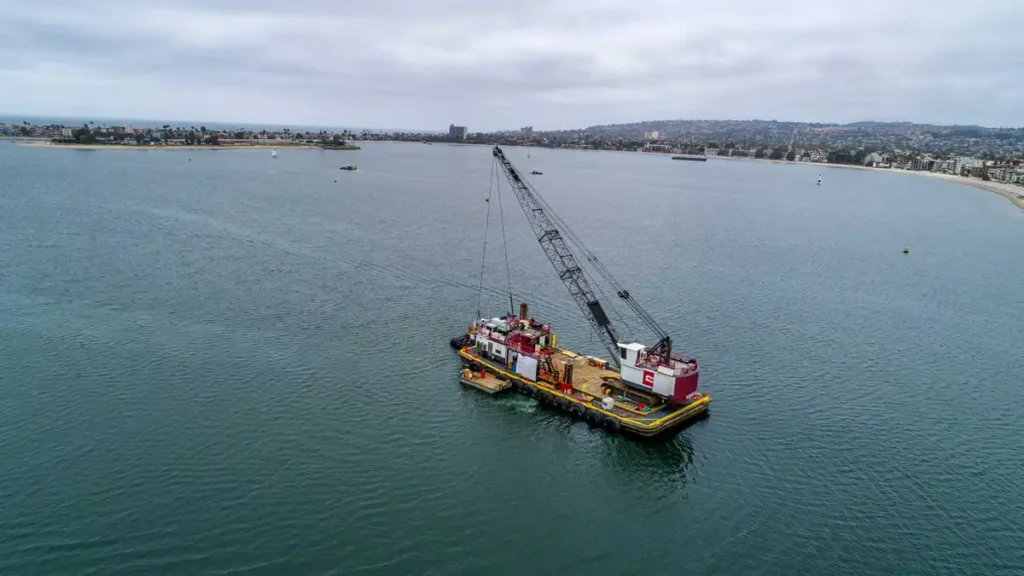
Coastal Marinas and Harbors
Coastal locations such as Marina del Rey, Newport Beach, Long Beach Harbor, and San Francisco Bay require exact depth restoration to maintain safe vessel movement. Over-excavation can destabilize piers, seawalls, or nearby shoreline structures. RTK-enabled control offers reliable accuracy, making it indispensable for coastal dredging projects.
Case Example: Improving Outcomes with RTK GPS Dredging
While specific project names remain confidential due to client requirements and environmental restrictions, the measurable improvements seen across multiple CA Dredge Pros operations clearly demonstrate the transformational impact of RTK technology in real field conditions. These projects range from sediment removal in sensitive Delta channels to stormwater basin restoration in urban Southern California. In every case, the application of advanced digital positioning has produced more predictable outcomes, cleaner cut profiles, and reduced operational uncertainty.
Before RTK Integration
- Depth inconsistencies across dredged areas that often required rework or supplemental surveying
- Excessive material removal due to limited visibility and difficulty confirming exact grade lines
- Longer project cycles caused by manual depth checks, slower excavation rates, and inefficient planning
- Additional surveying shortages, leading to delays, cost overruns, and challenges meeting regulatory timelines
After Deploying Precision Dredging Excavators
- Controlled dredge lines within centimeter accuracy, allowing operators to work confidently within narrow boundaries
- Streamlined workflow and shorter project durations as RTK positioning removed guesswork and reduced rework requirements
- Lower material handling and disposal volume because operators removed only the sediment needed to meet design specifications
- Improved compliance documentation for state permitting, supported by digital logs and verifiable dredge data captured in real time
These results demonstrate why RTK GPS dredging is rapidly becoming the standard across the industry, especially for contractors working in highly regulated California waterways where accuracy, accountability, and environmental stewardship are essential.
Technical Overview: Why RTK Outperforms Traditional GPS
| Technology Type | Accuracy Level | Suitable For | Limitations |
| Standard GPS | 1 to 3 meters | Basic mapping | Too inaccurate for dredging |
| Differential GPS | 20 to 50 centimeters | Surveying | Insufficient for precision cuts |
| RTK GPS | 1 to 3 centimeters | Precision dredging excavators | Requires reliable base station signal |
This table highlights how standard systems cannot meet the strict operational demands of California waterways dredging, while RTK provides the control necessary for environmentally sensitive work.
Future of Precision Dredging in California
As state agencies continue tightening environmental guidelines, demand for RTK GPS dredging will grow. Climate change is reshaping California’s hydrology, increasing the need for adaptable, high-accuracy dredging solutions that protect infrastructure and ecosystems.
Emerging innovations include:
- Integration with autonomous monitoring drones
- Digital twin modeling for dredge planning
- AI optimizing dredging patterns
- Real-time turbidity monitoring
CA Dredge Pros is already adopting and preparing for these advancements, reinforcing their leadership in precision-focused California waterways dredging.
Conclusion
California is a state where every waterway carries environmental, economic, and community significance. Traditional dredging methods simply cannot meet the precision, compliance, and ecological safety required today. RTK GPS dredging has emerged as the essential standard, enabling operators to work with exact depth, positioning, and control across rivers, harbors, reservoirs, and flood channels.
With a strong track record in delivering high-accuracy results, CA Dredge Pros stands out as one of the few companies with deep expertise in integrating precision dredging excavators and RTK positioning systems into complex projects. Their work in California waterways dredging reflects a commitment to environmental responsibility, operational excellence, and client value. As hydrological challenges continue to evolve, their approach is setting new benchmarks for quality, compliance, and performance statewide.
CA Dredge Pros does more than complete dredging projects. They restore waterways with precision, protect local ecosystems, and ensure communities across California can rely on resilient water infrastructure for decades to come.